The RV Investigator is currently undertaking oceanographic research along the 110°E meridian off Western Australia as part of the second International Indian Ocean Expedition. The voyage is led by Professor Lynnath Beckley of Murdoch University and the research is supported by a grant of sea time on RV Investigator from the CSIRO Marine National Facility.
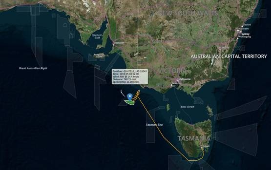
We are currently about 120 km west of Cape Leeuwin, one of the world's "Great Capes". Remarkably, at Cape Leeuwin there is a plaque commemorating the fact that on 6th December 1801, Captain Mathew Flinders, Commander of HMAS Investigator, sighted Cape Leeuwin and started mapping the Australian coast. Now, on the modern 93m RV Investigator, we are on our way to map the south-east Indian Ocean repeating an oceanographic voyage conducted way back in May and June 1963 by the HMAS Diamantina as part of the first International Indian Ocean Expedition.
|
Date: May 16, 2019 |
Time: 1200 AWST |
|
Latitude: 37.143°S |
Longitude: 111.712°E |
|
Wind direction: 182°(S) |
Wind speed: 22 knots |
|
Swell direction: SE, S |
Depth: 5,176 m |
|
Air temperature: 11.5°C |
Sea temperature: 16.0°C |
|
Notes: Ship steaming to the first station of the 110°East line, albatrosses soaring and Antarctic and pygmy blue whales calling. |
|
The most reliable way we have to track global warming is by measuring the change in temperature in the ocean. This is because the ocean is absorbing more than 90% of the extra heat. Most of the global warming heat is in the upper 1000 m of the ocean. However, around Antarctica, the surface waters become saltier and heavier as sea ice forms in winter, and they sink all the way to the bottom of the ocean. These Antarctic Bottom Waters spread northward filling the deepest parts of the ocean, including the Indian Ocean, contributing to sea level rise as they warm.
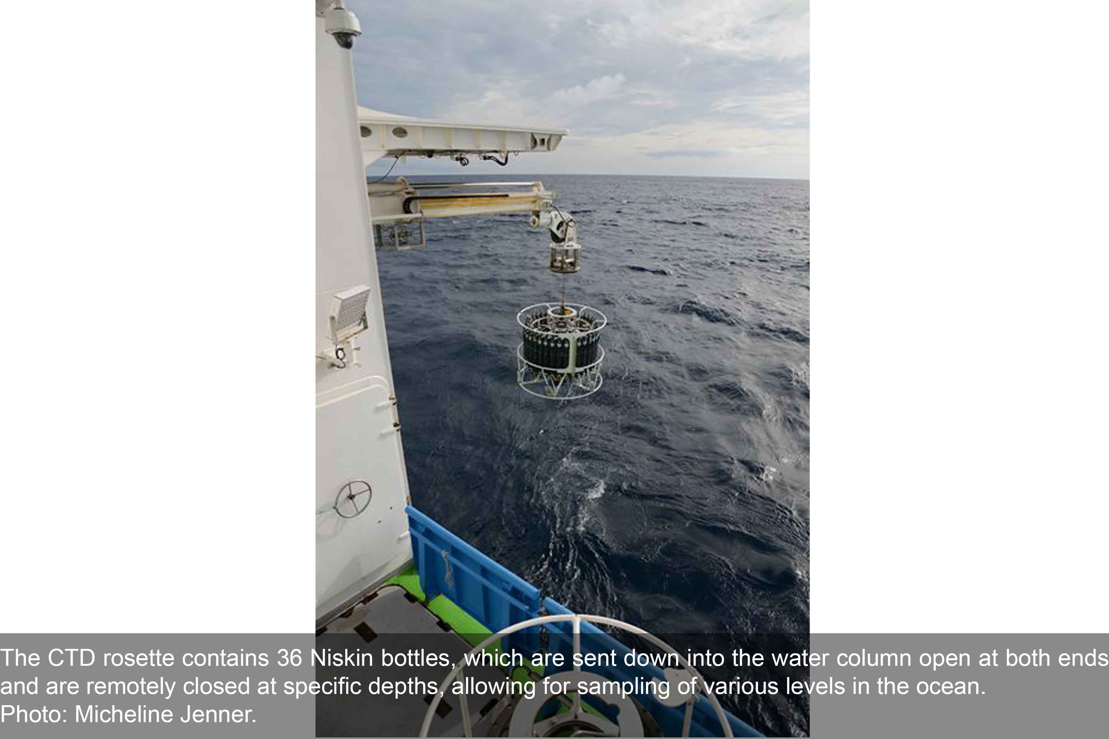
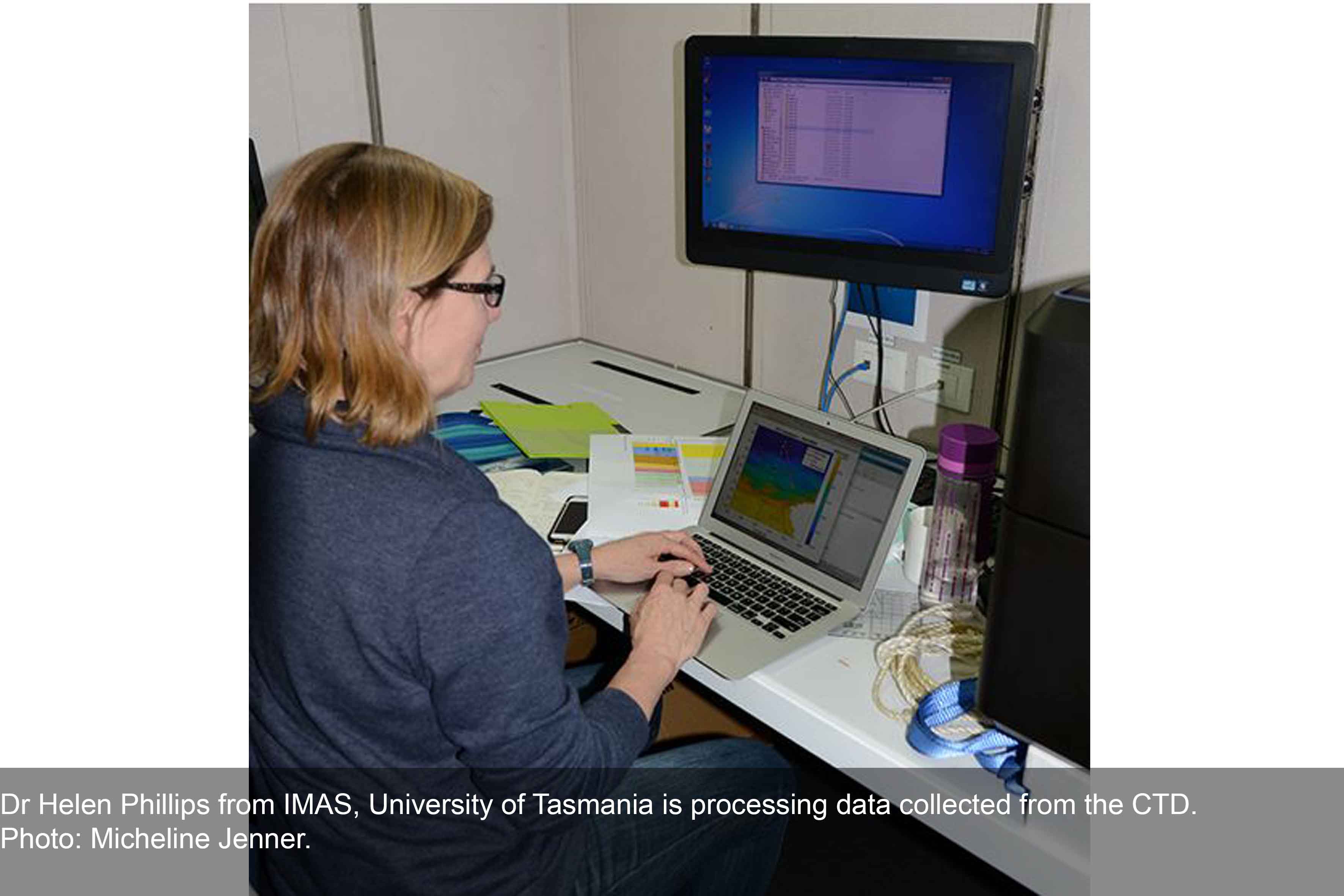
The best way to measure the deep ocean below 2000 m is using a CTD-a Conductivity, Temperature and Depth profiler, lowered from a research vessel. The electronic sensors of the CTD are positioned within a large frame (the rosette) around which are 36 12-litre bottles that are used to capture water at different depths. This water is extremely valuable to the scientists on board as direct chemical analysis in our laboratory is the primary way to measure some water properties and also provides a critical check on the accuracy of the electronic measurements. Biological studies also need actual samples of water to identify tiny microbes in the water. This labour-intensive, costly work means that measurements in the deep ocean are infrequent and sparsely distributed.
On the first International Indian Ocean Expedition in the 1960s, the CTD was not yet invented, but bottles could be lowered to collect water samples at specific depths, and a reversing thermometer was used to record the temperature at depth. So there are measurements of the properties of the bottom waters from the 1960s. Sixty years later, our new measurements will reveal how rapidly the changes already detected around Antarctica have progressed into the Indian Ocean, and will help to guide our predictions of future warming and sea level rise. In addition to bottom water changes, we will be able to measure changes at all levels, not only in temperature but in the chemical composition and biological diversity, as well.
Be sure to follow the daily posts of the Log from One Ten East on the IIOE-2 voyage at https://iioe-2.incois.gov.in and https://wamsi.org.au