ESSO - Indian National Centre for Ocean Information Services
(An Autonomous Body under the Ministry of Earth Sciences, Govt. of India)
About ARGO
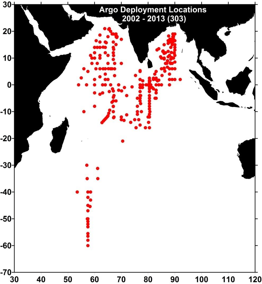
Argo is an international project to collect information on the temperature and salinity of the upper part of the world's oceans. Argo uses robotic floats that spend most of their life drifting below the ocean surface. They make temperature and salinity measurements when they come up to the surface and after transmitting their data to satellites, they return to depth to drift for 10 days. The drifting depth and the cycle period can be programmed apriority based on individual requirements. By 2007, proposed array of 3000 floats producing 100,000 temperature/salinity profiles per year are deployed in the Global Ocean. In Indian ocean there is plan to deploy 450 float by various participating countries out of which India committed to deploy 150 floats.

Data from all these Indian floats upon transmission to ARGOS satellites are obtained from satellite data acquisition and processing system installed at INCOIS. This data is encoded in Hexadecimal format and which is decoded and individual profiles are obtained. These profile data are subject to Real Time Quality Control (RTQC) and uploaded on to Global Data Centre (GDAC) within 24 hours. The profiles are also subject to Delayed Mode Quality Control (DMQC) by respective PI and are made available to scientific community once in 6 months.
Many value added products are generated utilizing these data sets. Value added products, based on individual float data is generated to access the performance of the float over a period of time. Data from all the floats are objectively analyses and spatial products on ranging between 10 days - month is generated. Data from all these floats along with the value added products are made available on INCOIS web site and also on INCOIS Live Access Server (LAS) for free access.

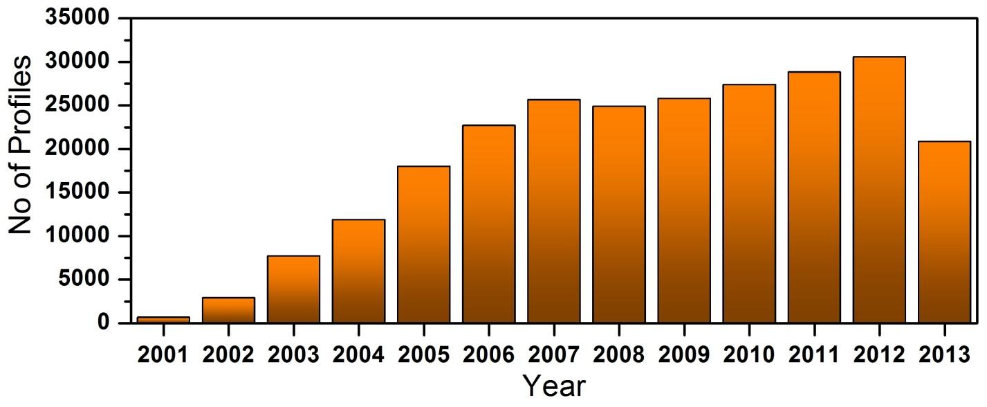
Figure: Year-wise distribution of temperature-salinity profiles measured by Argo floats in the Indian Ocean.


